


Buck-Ant-End Precinct, Jefferson County, Nebraska
About
Outline

Summary
| Unique Area Identifier | 613285 |
| Name | Buck-Ant-End Precinct |
| County | Jefferson County |
| State | Nebraska |
| Area (square miles) | 137.19 |
| Land Area (square miles) | 135.95 |
| Water Area (square miles) | 1.24 |
| % of Land Area | 99.09 |
| % of Water Area | 0.91 |
| Latitude of the Internal Point | 40.06036310 |
| Longtitude of the Internal Point | -97.18635110 |
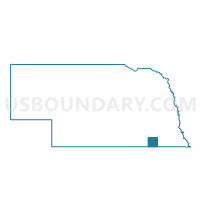
Maps

Graphs
Select a template below for downloading or customizing gragh for Buck-Ant-End Precinct, Jefferson County, Nebraska


Neighbors
Neighoring Voting District (by Name) Neighboring Voting District on the Map
- Albion Township Voting District, Republic County, KS
- Alexandria-Gilead Precinct, Thayer County, NE
- Byron-Chester-Hubbell Precinct, Thayer County, NE
- Cub Creek-Rock Creek Precinct, Jefferson County, NE
- Fairbury Ward 1, Jefferson County, NE
- Fairbury Ward 2, Jefferson County, NE
- Franklin Township Voting District, Washington County, KS
- Highland Township Voting District, Washington County, KS
- Jeff-Pleas-New Precinct, Jefferson County, NE
- Lin-Mer-Fby-Rich Precinct, Jefferson County, NE
- Lowe Township Voting District, Washington County, KS
- Union Township Voting District, Washington County, KS
Top 10 Neighboring County Subdivision (by Population) Neighboring County Subdivision on the Map
- Fairbury city, Jefferson County, NE (3,942)
- Chester precinct, Thayer County, NE (696)
- Alexandria precinct, Thayer County, NE (431)
- Pleasant precinct, Jefferson County, NE (411)
- Fairbury precinct, Jefferson County, NE (386)
- Endicott precinct, Jefferson County, NE (217)
- Rock Creek precinct, Jefferson County, NE (181)
- Newton precinct, Jefferson County, NE (163)
- Antelope precinct, Jefferson County, NE (162)
- Albion township, Republic County, KS (142)
Top 10 Neighboring Place (by Population) Neighboring Place on the Map
- Fairbury city, NE (3,942)
- Endicott village, NE (132)
- Reynolds village, NE (69)
- Steele City village, NE (61)
Top 10 Neighboring Unified School District (by Population) Neighboring Unified School District on the Map
- Fairbury Public Schools, NE (5,796)
- North Central - Washington Schools Unified School District 108, KS (2,652)
- Diller-Odell Public Schools, NE (1,547)
Top 10 Neighboring State Legislative District Lower Chamber (by Population) Neighboring State Legislative District Lower Chamber on the Map
Top 10 Neighboring State Legislative District Upper Chamber (by Population) Neighboring State Legislative District Upper Chamber on the Map
Top 10 Neighboring 111th Congressional District (by Population) Neighboring 111th Congressional District on the Map
Top 10 Neighboring Census Tract (by Population) Neighboring Census Tract on the Map
- Census Tract 9636, Jefferson County, NE (3,294)
- Census Tract 9786, Washington County, KS (3,233)
- Census Tract 9637, Jefferson County, NE (2,935)
- Census Tract 9632, Thayer County, NE (2,457)
- Census Tract 9638, Jefferson County, NE (1,318)
- Census Tract 9781, Republic County, KS (1,133)
Top 10 Neighboring 5-Digit ZIP Code Tabulation Area (by Population) Neighboring 5-Digit ZIP Code Tabulation Area on the Map
- 68352, NE (5,222)
- 68370, NE (2,075)
- 68342, NE (530)
- 66958, KS (314)
- 68350, NE (216)
- 66960, KS (167)
- 66946, KS (126)
- 68375, NE (121)
- 66955, KS (114)
- 68440, NE (110)